Barbados, Island in the sun, is the most easterly of the Caribbean group of Islands. It is situated in the Southeastern Caribbean at a location of 13 degrees 5 minutes North Latitude and 59 degrees 36 minutes West Longitude.


It is surrounded on North, East, and South Coasts by the clear blue waters of the Atlantic Ocean,

While the west Coast is surrounded by the calm, clear waters of the Caribbean Sea.

Area: Barbados measures 21 miles long from its southern most point to it northern most point and 14 miles wide at its widest point for a total land area of 166 square miles. It is divided into eleven geographical areas called parishes.

1625 - 1644. English Colonization. After a brief period of occupation by the Portuguese, the British began its colonization when the first English ship touched the island on May 14th, 1625, under the command of Captain John Powell. The island was therefore claimed on behalf of King James I.

On February 17th, 1627, Captain Henry Powell return to the island with a party of 80 settlers and 10 slaves to occupy and settle the island. This expedition landed in Holetown formerly known as Jamestown.
History of Capital of Barbados, Bridgetown

The capital of Barbados is known as Bridgetown and is situated in the Parish of St Michael. Bridgetown has a rich history, as seen by some century old British colonial architecture. Bridgetown was built in the 17th, 18th and 19th centuries and was known at first as the Town of St. Michael before being named Bridgetown.


Bridgetown is home to many historical sites and attractions that are worth visiting. It is home to the Parliament Buildings of Barbados, Independence Square.

Golden Square Freedom Park,

St. Michael Cathedral.

The Chamberlain Bridge or Swing Bridge.

Which allows entry into the inner basin of the Careenage,

And Carlisle Bay which is a small natural harbor.
Parliament: The Parliament Buildings of Barbados are located at the top of Broad Street in the Capital City of Bridgetown. The Barbados Parliament was established in 1639 and is the third oldest Parliament in the entire Commonwealth.


After approximately 340 years of being a British Colony, Barbados received its Independence from Britain on November 30th, 1966. Former Premier Errol Barrow became Barbados’s first Prime Minister.

To celebrate and recognize Barbados’s Independence, Independence Square was created from a former car park. It sits along the careenage waterfront at the foot of the Chamberlain Bridge and Independence Arch.

The Parliament Building and Clock Tower sits in the background. In the square itself is a statue of former Prime Minister of Barbados Errol Walton Barrow considered the Father of Barbados Independence.


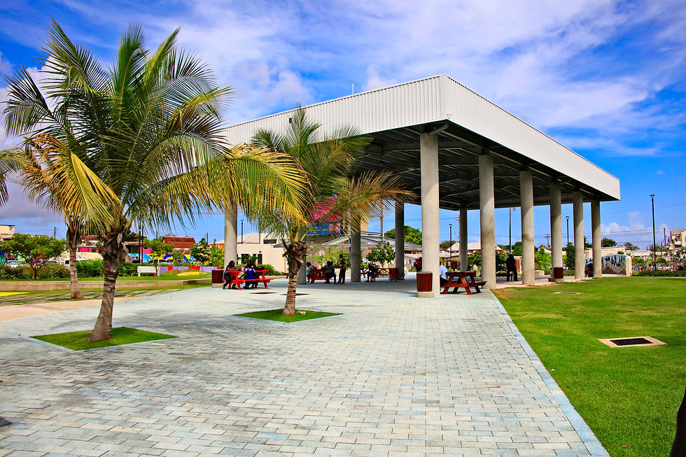
Diagonally across from Independence square is Golden Square Freedom Park which was open in November of 2021 just before Barbados became a Republic. Golden Square Freedom Park which is situated in the center of Bridgetown symbolizes resistance against the oppression which was prevalent in Barbados during the 1930’s.


Main features of the park are the Builders of Barbados Wall on which the Surnames of People who lived in Barbados.


Artifacts of early Barbados way of life, and finally, a Bust of Early Barbadian Freedom Fighter and National Hero, Clement Payne.

The flag of Barbados has three equal vertical stripes along the flag height, a yellow stripe in the middle bordered by two blue stripes. The middle center stripe has a black broken trident head facing upwards vertically on it.
The first Blue Stripe on the left of the Barbados Flag stands for the Sky, the middle Yellow stripe stand for the Sand, and the right Blue Stripe represents the Blue Sea


The Black Trident at the center of the flag has its handle broken off representing Barbados’s breakaway from Britain by Independence. The Trident has three points to represent the three Principles of Democracy: A Government of the People, by the People for the People.

On, November 30th, 2021, Barbados moved away from being a Parliamentary Constitutional Monarchy system of Government to a Unitary Parliamentary Constitutional Republic with Mia Amor Mottley as Prime Minister and Head of State.

The Port of Bridgetown is situated at the northwestern portion of Carlisle Bay.

The Port handles all of the Passenger Cruise Liners and International Commercial shipping that visit the Island.


Bridgetown is also the home of Governmental Offices, Financial Center.


The Garrison Savannah, Kensington Oval the Home of Cricket, and the center for shopping and other commercial activities
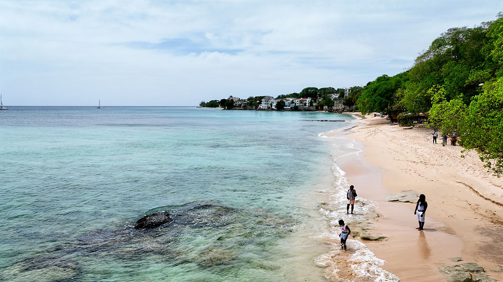
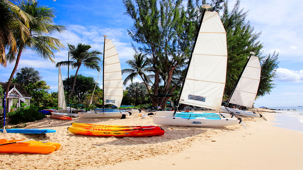
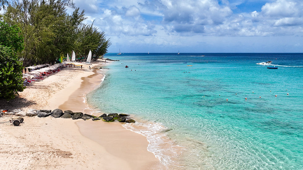
Bridgetown is blessed to have some fantastic beaches in its immediate vicinity. Extending from the Careenage to Needham Point at the southern end of Carlisle Bay lies three of the best beaches in Barbados, Browne’s Beach, Pebble Beach, and Needham Beach.
Browne’s Beach extends from the edge of Bridgetown on Bay Street until it joins to Pebbles at Radisson Hotel. It occupies the northern part of Carlisle Bay on the Caribbean Sea coast of the Island.


The calm clear waters are perfect for swimming, snorkeling, diving, scuba diving, jet skiing, kayaking, paddle boarding and other such activities.


Just offshore out in the bay is the site of various sunken vessel that helps in the formation of artificial reefs that is populated by a large variety of tropical fish, providing the perfect opportunity for scuba diving.
These artificial reefs can also be view from the surface from glass bottom boats also a forty-five-minute underwater submarine dive.


The white sandy beach is perfect for beach activities such as jogging, walking, sun -bathing and relaxing. Along the beach front are entertainment establishment such as Harbor Lights and the Boat Yard offering daytime services such as drinks, food, showers boat rides, beach chairs and umbrellas. While at night these same establishments provide live entertainment, dinner, and DJ music.


Pebbles Beach is divided from Browne’s beach by the Radisson Hotel Marina, and it extends all the way to Needham Point. Pebble Beach is made up of white, soft sand, while the gentle waves of clear, warm, aquamarine Caribbean Sea lap against the sand.


Since Pebbles Beach like Browne's Beach is part of Carlisle Bay, many water based activities are available.
Activities include, swimming, scuba diving, snorkeling, kayaking, paddle boarding, boating, Jet skiing. Sailing is another popular activity indicate by the many sailing boats and yachts anchored offshore. Pebbles Beach is overlooked by the Hilton Hotel which sits on Needham's Point.


At the southern tip of Carlisle Bay lies the historical Needham’s Point. The property is occupied by the Hilton Hotel and grounds.

The grounds which is accessible to victors, hosts an esplanade that offers a 180 degrees panoramic view of Carlisle Bay from the Bridgetown Port all the way around to nearby Drill Hall Beach.

Needham’s Point at one time in the past was used in defense of Carlisle Bay which was a natural harbor as the remanent of canons suggest.


With it calm clear waters Needham’s Point beach is a favorite place for sea bathing as there are two other interconnecting beaches nearby. First is the afore mention Pebble Beach to its north and to the South is The Drill Hall, Hastings Beach.

Drill Hall Beach which is just to the east of Needham point beach is located along the Hastings coast on the border on the Parishes of St Michael and Christ Church.
It has wide shaded areas with picnic benches making it a good place for relaxing. The beach is made up of white sand, the water is clear and aquamarine in color, but since it is on the Atlantic Side of the south coast the waves are a little more active making it a good location for surfing. One can walk along the beach via a boardwalk all the way to Rockley and Accra Beaches to the east.


At the northwestern edge of Bridgetown just to the west of the Bridgetown Port running parallel to the Mighty Grynner Highway lies two beaches, Brandon's and the connecting Brighton Beach.


Brandon's beach is a few minutes’ walk from the Bridgetown port making it an ideal place to visit for cruise ship passengers on a cruise. The beach is made up of soft sand, with clear calm waters making it suitable for swimming and sea bathing and sunbathing. Amenities include bathroom and changing facilities. There is an active lifeguard station on site.
Just around the corner from Brighton Beach is Paradise Beach which adjoins Batts Rock Beach. Batts Rock Beach and Paradise Beaches are perfect for picnicking. Batts Rock Beach offers food and drink facilities and is quite popular for swimming and sunbathing by visitors.


Near Batts Rock beach in St James is Fitt's village beach. As usual the waters around the beach are clear and calm with an offshore reef making it an ideal spot to swim and snorkel. The beach itself is normally quiet and is tree lined ideal for relaxing.


Barbados also has three other smaller coastal towns which are, Oistins located in the Parish of Christ Church, Holetown situated in the Parish of St James and Speightstown located in the Parish of St Peter.


Oistins is located on the southern coast of the Parish of Christ Church about 6 Kilometers from Grantley Adams International Airport and about 12 kilometers from the Capital Bridgetown.


Oistins is a major fishing town with a modern fishing market and is one of the major attractions in Barbados. Each Friday and Saturday night many locals and foreign visitors assemble in Oistins for the Fish-Fry.


Fish-Fry is an opportunity to enjoy the local cuisine of fried and grilled fish, fish cakes, sweet potato, macaroni pie, and coleslaw and so much more while been entertain by pulsating Bajan music in a family friendly environment. There are numerous vendors to choose from and seating is readily available.


Overlooking Oistins is the Christ Church Foundation School, a coed Secondary High School that offers Secondary level education from First Form to Sixth Form.
Since Oistins is an important fishing and commercial area public transportation is readily available to Bridgetown, Grantly Adams Airport, and to the eastern and northern parts of Barbados.


Located next to Oistins is beautiful Miami Beach in Enterprise. Miami Beach offer visitor and local alike a beautiful place to picnic, relax, sunbathe or to enjoy a relaxing, soothing sea bath in the calm, clear, aquamarine water of the Atlantic Ocean.


The beach itself is lined with coconut, almond and casuarina trees at the back, underneath which, are picnic tables. Miami beach offers bathroom and changing facilities and has a lifeguard station.
Overlooking the beach from Enterprise Road is a low hanging cliff that offers the visitor a fantastic view especially of the setting sun. On the eastern side of the beach the waves are more active good for bodysurfing and boogie boarding, while the western side offers more protection from the incoming surf resulting in a smoother calmer place to swim.


About half mile away to the east of Miami Beach located on Enterprise Road Atlantic Shores is a small scenic beach known as Cotton House Bay. During the daytime especially at low tide the beach has soft powdery cream- colored sand next to a low hanging cliff.


The beach is ideal for swimming, snorkeling, or paddle boarding as the water is usually calm.
Access to the beach is by steps, which has a semi-circular lookout area in the middle of the descent down to the beach. From there one has a commanding view of Oistins Bay to the west.


Just to the west of Oistins is the lovely Welches Beach situated in the middle of Oistins Bay along Maxwell coast road. The beach itself is long and wide expanse of white, powdery soft sand ideal for walking, jogging, or sunbathing. The water is calm ideal for swimming, with an onshore breeze good for kitesurfing and windsurfing.


Holetown: Holetown, Barbados fourth largest town by population is located on the west coast of Barbados in the Parish of St. James. Holetown was the site of the first British landing in Barbados in 1625 and the first settlement by the British two years later in1627.
The Holetown Monument which commemorates the 1625 landing was erected in 1977 to celebrate the 350th anniversary of the first settlement.


Holetown is situated in in an area that contains some of the most exclusive Hotels, Private Residences and Gated Communities in Barbados making it a prime area for exclusive shopping and entertainment.


To the immediate south of Holetown is Sandy Lane Hotel and Golf course and beach. Sandy Lane beach leads into Paynes Bay Beach. Paynes Bay Beach is one of the more beautiful beaches with its aquamarine clear calm waters and shallow reefs it is ideal for swimming and snorkeling and relaxing in the shaded areas.


Along with swimming and snorkeling other water sports include jet skiing and kayaking and catamaran sailing. Major hotels are situated in the area so Paynes Bay Beach can get a little congested, but it is still a beautiful area to relax especially, to take in the beautiful sunset.
Situated in the northern part of Holetown is Limegrove. Limegrove offers the best and most exclusive shopping experience in Barbados with an exclusive array of luxury and duty-free items such as jewelry, apparel, and accessories available for purchase.


The indoor shopping mall features more than 100,000 square feet of indoor space housing some of the world’s leading retail brands such as Longchamp, Ralph Lauren, Michael Kors, Gucci, Cartier, Diamonds International, Tag Heuer, Hublot, Bvlgari, Colombian Emeralds International as well as many specialty retailers such as Coco de Mer, Timothy Oulton, and Butterfly Boutique.


In addition to shopping, Limegrove features an art gallery, spa, two cinemas, several bars, restaurants and eateries, also included in this space is The Grove Residences.
Limegrove is classify as the most stylish place to shop and dine in Barbados. Limegrove is conveniently located near major hotels on Barbados West Coast and is unquestionably one of the top places to visit in Barbados.


Near Limegrove on the waterfront is Holetown Beach. This lovely beach is located in the heart of the of Holetown. The warm, calm, aquamarine-colored waters create the perfect conditions for swimming, relaxing and sea bathing. Other activities include kayaking, waterskiing and jet skiing.


On the southern end of Holetown beach there is boardwalk for walking along the waterfront. While on the northern end the boardwalk continues to Folkstone Marine Park.


Folkestone Marine Park is located just north of Holetown and south of Colony Club beach. Folkestone Marine Park features an artificial reef, purposefully formed by the sinking of the ship Stavronikita which rests in 120ft of water less than half a mile from the shore.
The beach is located within easy walking distance of many west coast hotels, villas, and holiday residences. It is also conveniently located directly on the main bus route.


The Park has an exclusive recreational zone set aside for snorkeling and swimming. The reef is about one-third of a mile offshore and is home to numerous fish, sea anemones, sea lilies, corals, and sponges.
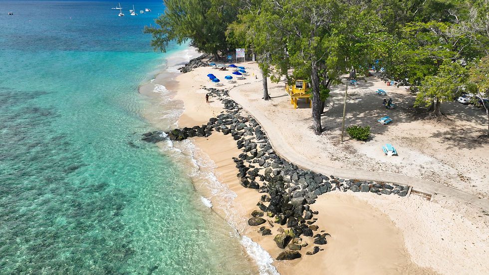
The calm waters and gentle waves at Folkestone Marine Park also make it the ideal spot for kayaking and paddle boarding. The park also has facilities for picnicking and relaxing.
The board walk continues northward from Folkestone Marine Park towards Colony Club Beach also known as Heron Bay
beach.

Numerous watersports activities, including jet skiing, parasailing, kayaking, and catamaran sailing are available at Colony Club beach.


Towards the northern end of the beach are shallow reefs where snorkelers can spot colorful tropical fish and other marine life. Colony Club Beach extends into Alleyne’s Bay Beach.
Alleyne’s Beach Bay can be reached by walking north from Colony Club Beach, in fact you can walk along the beach front from Folkestone Beach Park all the way to Alleyne’s Bay.

It is quieter less congested than Colony Club Beach. The water as usual is clear and calm ideal for swimming and snorkeling.
Two beaches just north of Alleyne Bay is Weston Beach located in Weston St James and Reeds Bay. Weston Beach has soft gritty sand; the waters are clear and calm ideal for swimming and snorkeling. The south part of the beach is a bit rocky and has trees that provide shade.


Reed Beach which, is much larger than Weston Bay Beach is a little more active as it is frequented by fishing boats, catamarans, and jet skis. However, it is still a fantastic beach to visit for swimming and snorkeling as there is a special area marked out for these activities and is tree lined ideal for relaxing in the shaded conditions.


Speightstown is Barbados second largest town situated along the northwest coast of St Peter. Speightstown is influenced by its history that dates back to its early settlement by its buildings and its fishing port.


Beaches and places of interest to the north of Speightstown are Heywood's Beach, Port St Charles, Port Ferdinand, and Smiton's Bay.
Heywood's Beach is located just outside Speightstown. The beach has soft cream-colored sand with a stone water break to prevent beach erosions. The water as usual is calm, clear and beautiful for swimming or snorkeling. A modern jetty project out into the sea available for a more breathtaking experience


The Port St Charles Marina located in Heywood's St Peter is a luxury marina that offers beautiful sea front or beach front one-to-five-bedroom homes for short stay to permanent dwellings. Each dwelling has its own berth and dock for private boat or yacht. The 22-acre community is made up mainly of villas, condo, and apartments.


On a man-made island facing the beach is the Pier One Restaurant that offers fine dining and bar services for lunch and dinner right on the open-air waterside. While waiting to be serve on can take a quick dip in the beautiful aquamarine water or any of the available pool.


Located next door to Port St Charles on the Platinum west coast of Barbados is Port Ferdinand. Port Ferdinand offers luxury style one-, two- and three-bedroom residences for short time stay or permanent ownership. It is a residential resort, private club and docking marina all in one.


Mullins Beach to the south of Speightstown is a small, but beautiful and popular beach in the Parish of St Peter. It is a splendid place to relax, swim, sunbathe, or engage in other water activities such as kayaking, paddle boarding and jet skiing.


It is mostly frequented by visitors to the island as it offers a breathtaking view of the gentle Caribbean Sea especially at sunset.


Just north of Port St. Charles in Clinketts St Lucy is Smiton’s Bay Beach. Smiton’s Beach is quiet and friendly right next to the road. The beach is made up of cream-colored soft sand is usually uncrowded making it a good place to relax and unwind. The water is calm and clear with gentle waves ideal for swimming.


t the south end of the beach is the Fish Pot Restaurant, a place where one can grab their favorite cocktail, drink, or indulge in a light romantic dinner while viewing the fantastic west coast sunset.
The Parish of St Lucy occupies the northern top of the island of Barbados from the gentle Caribbean Sea on the west coast to the fierce and hostile Atlantic Ocean on the east side.
Noteworthy beaches in St Lucy includes Archers Bay, River Bay, Little Bay, and Cove Bay.

Archers Bay is located along the rugged north coast of Barbados where the mighty Atlantic Ocean begins to merge with the Caribbean Sea. The sea itself is blue in color with shades of aquamarine with strong waves. Archers Bay is overlooked by cliffs lined with trees and grass. The area is very much isolated and secluded, making it ideal for picnicking, hiking and photography.


River Bay is located to the east of Archers Bay, just south of North Point. River Bay has been a popular picnic spot for many, many years especially on Bank holidays and to a lesser extent on weekends. The cliffs overlooking River Bay is the best place for a panoramic view of the coast and the two cove inlets that flood with water at high tide.


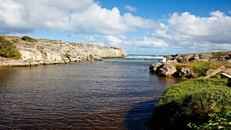
Little Bay is located on the northeast of St Lucy between River Bay and Cove Bay. It is surrounded by rugged cliffs that offer a fantastic view of majestic waves crashing into the coral reef that protect a pool that is ideal for swimming. The beach itself is made up of coarse sand.


The coral reef is filled with blow holes and as the waves crash into the rocks pressure drives plumes of water out of the holes.


Just minutes away from Little Bay is Cove Bay which is a famous picnicking spot. Cove Bay is situated between Pico Tenerife to the south and Paul’s Point to the north.


The landscape around Cove Bay is diverse from a flat grass and tree covered plateau to the north side that rises in stages to a Hight area that overlooks the beach itself presenting a picturesque view of the entire east coast of Barbados all the way to Ragged Point in St Philip.

The cliff itself is made up of white chalk and is very rugged, making it very difficult to access the beach.

Land mass and Geography:
The land mass of Barbados is mainly coral limestone. The coral rocks have great water filtering benefits. When it rains, water seep through the limestone which naturally filters it, into the ground beneath. This water is then stored in various underground reservoirs to be used for drinking water.
The surface of the ground has a layer of usually fertile soil which is ideal for natural, and artificial vegetation to flourish and cover the hillside and plains. This fertile and arable soil of the island is conducive for the growing of various agriculture crops mainly sugarcane, and ground provisions such as sweet potatoes.


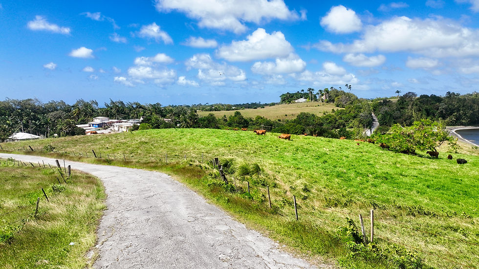
The center of the island mainly consists of gentle sloping hills that run parallel to the coast, and this is the area that is generally ideal for the growth sugar cane, ground provisions, and animal husbandry mainly cattle, black belly sheep, and chickens.


On the northeast coast that faces the Atlantic Ocean lies the Scotland District. The Scotland District is an area with large areas of exposed rock cropping made up mainly of clay, chalk, shale, sandstone, and coral.

The soil content of this area is very useful in the construction and pottery industries as it the main supplier of the needed ingredients for the making of cement, pottery, and other building materials.
Here one will find a rugged out-cropping known as Chalky Mount that rises to a height of 548 feet towering over East Coast Road.


Chalky mount and the surrounding areas offer to the visitor fantastic and scenic views of the beautiful Atlantic Ocean, East coast and Cattlewash.
Cattlewash is located along the East Coast Road from just north of Bathsheba all the way to Barclays Park in St. Joseph. Cattlewash is the longest stretch of beach in Barbados at over a mile long. It is an ideal area for walking and picnicking especially at Barclays Park.


The beach itself is usually peaceful but because the sea has strong offshore currents it is not ideal for swimming, but at low tide shallow pool created by the reef are good for bathing in. Additionally experience surfers enjoy the large waves at Cattlewash.


Just North of Chalky Mount off the beaten track is a series of sand dunes and another sandstone mount that rises to a height of approximately 188 feet. At the base of this stone mount to the south is Walker’s beach and Long Pond.


Walkers Beach is situated between Long Pond and Lakes Beach joining them to the much longer Morgan Lewis Beach. The entire area is ideal for walking and sightseeing and photography however in recent years it has been covered by seaweed.


To the North of Walkers Beach is Morgan Lewis beach that stretches for hundreds of yards. This location also includes a body of water known as Green Pond.


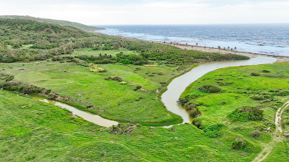
The abundant supply of water is conducive to the grown of lush vegetation including coconut trees, grape trees, shrubs, reeds, grass, and bushes.
Overlooking Morgan Lewis Beach is Morgan Lewis sugar windmill which was the last mill to operate in Barbados for the grinding of sugar cane. It stopped commercial operation in 1947 and now is a tourist attraction


Leaving Morgan Lewis, the landscape rises until it reaches Cherry Tree Hill. Cherry Tree Hill is located in the Parish of St Peter and offers a commanding view of Barbados rugged east coast.
The roadway, which connects the east and west coasts of the island was originally lined with cherry trees which were replaced with Mahogany trees in 1763.
The first of their kind on the island many of these original Mahogany trees still stand today. Visitors can walk along this beautiful throughfare and enjoy the peaceful tropical surroundings and breathtaking views of the east coast.
A short distance from Cherry Tree Hill to the Northwest lies another historical site, St Nicholas Abbey. St Nicholas Abbey’s great house built in 1658 is one of only three Jacobean style mansions remaining in the Western Hemisphere.


The great house first floor and dining room that has a table and chairs made locally from Barbadian Mahogany in 1850 and a beautiful collection China is available for viewing.
Located in the hills of St. Peter St. Nicholas Abbey is one of the finest historic sites in Barbados encompassing over 400 acres.


The gardens and surrounding land consist of sugar cane fields, lush tropical gullies, a mahogany forest filled with giant Mahogany trees, an ancient silk cotton tree, majestic cabbage palms and a selection of other flora and fauna in the gardens.


Visitors are welcomed to explore the gullies or take a ride on steam driven train.
Due to the decline of the sugar industry currently about 60 acres are planted and reaped annually for use by the syrup factory for the production of molasses and rum.
Rum
Barbados is widely credited as the birthplace of rum. The first commercial sugar cane was planted in Barbados around 1640 and the early settlers used the crop to create a poor-quality local beverage using crude distillation methods.

Over the next century distillation practices were significantly improved and Barbadian rum became renowned in both Europe and Colonial America. In 1890 St. Nicholas Abbey installed a steam engine helping the plantation to become one of the most successful on the island.

The mill which restored in 2006 is now used to grind sugar cane for St. Nicholas Abbey’s rum production.
St. Nicholas Abbey has a long tradition of producing rum. One of just four distilleries in Barbados, St. Nicholas Abbey still uses the traditional distillation process that made Barbadian rum famous for over 350 years.

St. Nicholas Abbey utilizes the age-old tradition and expertise of Master Distiller Richard Seale of R.L. Seale and Foursquare Factory Rum who has helped St. Nicholas Abbey to create a selection of internationally award-winning rums.

St. Nicholas Abbey Rum is made exclusively from sugar cane juice, which is stored as syrup to ensure year-round production The plantation cultivates and harvests a select variety of sugar cane unique to St. Nicholas Abbey by hand.

The freshly cut sugar cane is hand-fed into the steam mill where it is crushed just once to extract the sweetest juice possible. Soon after the juice is fed to a vacuum evaporator which reduces it to syrup to be stored for future rum production.


Continued attention throughout the ageing process has established St. Nicholas Abbey’s selection of rums as a premium brand, consistently praised as the best in its class.
Four Square Rum.
Located in the Foursquare St Philip Barbados on the site of a former sugar cane factory and sugar plantation that dates back to approximately 1720, you will find the magnificent Foursquare Rum Distillery and Heritage Park.


The distillery was re-opened by the Seale family in 1996. Distilling operations and blending are currently directed by Master Distiller Richard Seale of R.L. Seale& Co.

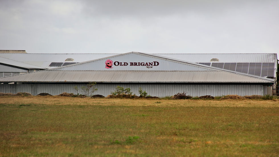
Foursquare Rum Distillery is well known for its wide-ranging collection of rums that includes the highly favored Doorly's, Old Brigand and E.S.A. Field brands.
Foursquare Rum Distillery was the proud winner of the Rum Distillery of the Year in November 2016 in London Britain.
Also, Foursquare Rums have won the title of Rum Producer of the Year for 5 consecutive years from 2016 to 2020. On top of these awards Foursquare Rum has received many trophies, gold medals, and praise from the International Spirits Challenge and the International Wine & Spirits Competition. Bottled Rum include R.L. Seale’s 12 Year Aged Barbados Rum.


Parish Churches in Barbados.
Around 1629, English settlers formed six original parishes on the island which were named Christ Church, St. James, St. Lucy, St. Michael, St. Peter, and St. Thomas.
By 1645, the land holding of Barbados increased and the shape of the original six were reconfigured giving way to five additional parishes. These were named St. Andrew, St. George, St. John, St. Joseph, and St. Philip.

It was common under the British System that each Parish had a single main Parishioner Church (or cathedral in the case of Bridgetown).
During the 1600’s, all the parish churches that came about were being Anglican after the Church of England tradition.

The Parish church System in Barbados depicted the visible representation of the parliamentary system of Government in Barbados. The differing size and shape of each parish were primarily influenced by the large plantation estates of cotton, sugar cane and tobacco that existed during the colonial years of Barbados.

When the first English settlers landed in Holetown around 1627, their chaplain quickly created a church for his congregation and in a short time an entire system of Anglican parish churches and rectories were built. Each church has its own unique architectural style and history.

The first parish church is said to have been between St. James Parish Church and St. Michael Parish Church (Now St. Michael Cathedral). All of the first structures were created with wood. The Parish structure of Barbados was set by Church of England each Parish having its own Church and burial ground.
St. Michael’s Cathedral.
This church was originally constructed of wood in 1641. The present church located at St Michael Row was built on a parcel of land that was donated by Col. William Sharpe for the expressed purpose of the rebuilding and expansion of the church in St. Michaels Row. The stone building was dedicated in 1789.


It has stained glass windows, with one featuring Michael the archangel with a drawn sword which is located directly behind the altar. The first Premier of Barbados Sir Grantley Adams, and his son John Michael Geoffrey Manningham “Tom” Adams who was a former Prime Minister are buried there along with the former Governor General of Barbados, Sir Winston Scott.
St Philip Parish Church.
Located in Church Village, St Philip, is the St. Philip Parish Church and burial ground. It represents the Chapel district of St. Philips. The present church is the fourth structure to occupy this general location.

The earliest historical record has the first structure dating from 1640 that was destroyed by a hurricane in 1780. The Church was later rebuilt in 1786 and that structure too was completely destroyed by the great hurricane of 1831. The Present Parish Church was rebuilt six years later and was consecrated along with the burial ground in October of that same year.

In 1977, the present structure was partially destroyed by a fire. It was then restored, combining some of the old traditional features with the modern aesthetics. The burial ground contains the remains of various Barbadian persons of importance.
St. Andrew Parish Church.
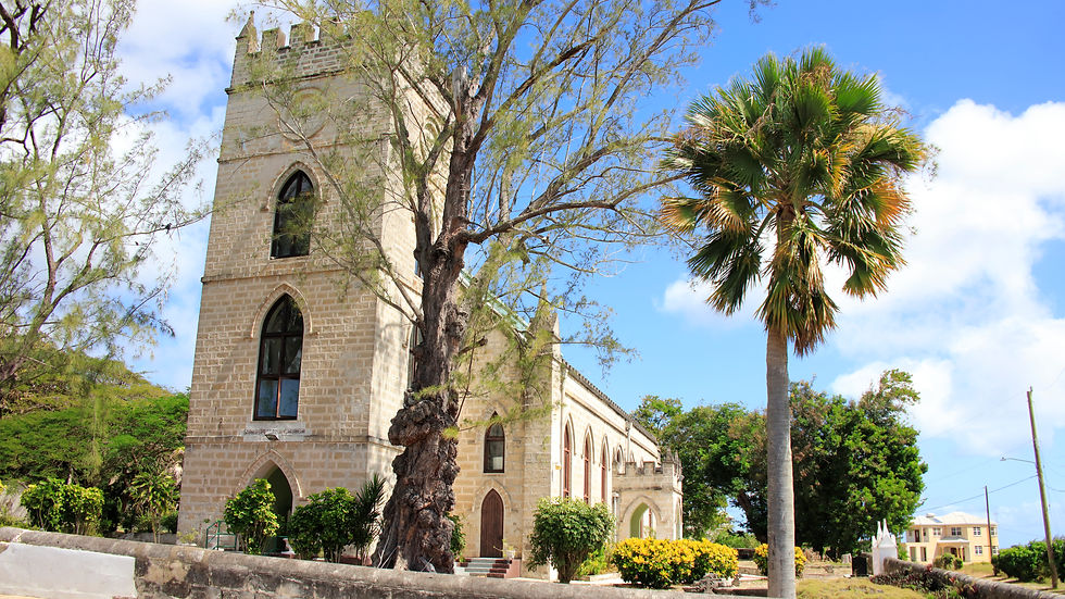
St. Andrew's Parish Church was established in 1630. This beautiful Barbadian church structure closely resembles a traditional English church with its gothic inspired architecture and square tower.


It was one of the only three Churches that survived the hurricane of 1831.
St. Andrew's Parish church is located north of the Bathsheba and Cattlewash coast on the eastern side of the island.
St John Parish Church and Burial Ground.
St John Parish Church which is located in the Parish of St John was originally built in 1645, it is one of the oldest churches in Barbados. In 1675 a hurricane badly damaged the new church, and it was torn down in 1676 rebuilt again.


Nearly 200 years later in 1831 the structure was again destroyed by one of the worst hurricanes on ever recorded. The church was then rebuilt 1836 with the Gothic inspired structure that is still standing today.
The burial ground contains the remains of some of Barbados noted families. It also contains the remains of Former Prime Minister of Barbados the Right Honorable David Thompson and one of only two intact sundials in Barbados which are still in use for telling time.


The Church is built next to the Hackleton's Cliff system which rises to a height of 1000 ft above sea level. This location offers one of the biggest draws for the scenic view which overlooks the fantastic East Coast that stretches from Ragged Point in St Philip to Pico Tenerife in St Lucy.


Hackleton’s Cliff is a landscape system that rises to an elevation of one thousand feet. It stretches from a portion of the Parish of St John to neighboring St Joseph. Beneath the small park that is located at the lookout point are several burial vaults of prominent persons that inhabited the area stretching back as far as the 1600’s.


At the foot of the cliff grows unspoiled lush tropical vegetation set against the backdrop of the blue waters of the Atlantic Ocean from. This fantastic view overlooks College Point and Martins Bay in St John, Bathsheba in St Joseph, Cattlewash and Chalky Mount in St Andrew.
The Island of Barbados is known for its white sandy beaches and clear blue, aquamarine waters. The white colored sand is the result of the coral reefs and limestone cliffs that mostly surrounds and protects the islands coastline.
The South and west coast of the island have some of the best beaches, Hotel, and private villa accommodations. Warm sunny days enhanced by calm clear, blue waters of the Caribbean Sea provides many opportunities for sea and beach activities.


The climate of Barbados is affected by the Northeast Trade winds which is conducive for comfortable daily temperatures and cool breezy nights. The southeastern, eastern, and northeastern parts of the island have a mostly rugged rock terrain, with many isolated bays and beaches.


Barbados offers one of the best wave windsurfing spots of the world. The northeast trade wind provides the perfect opportunity by creating the high waves and constant breeze that are perfect for jumping and wave riding along the shoreline.
The best place to windsurf and kitesurfing in Barbados is around the Silver Sands area that extents from Long Beach and Inch Marlow to the east of Silver Sands all the way west to Dover Beach on Maxwell Coast Road.


Inch Marlow is actually a series of small bays on the south part of Long Beach which extends for about two miles. Some of the bays have small beaches and calm waters that are safe for swimming, and kayaking, while at others the water is rougher with larger waves more suited to surfing, windsurfing and kitesurfing. In other areas the water edge is made up of very low jagged cliffs where the waves constantly crash over.


Silver Sands is a beautiful beach located on the southern tip of Barbados known as the surfing capital of Barbados. The beach itself is made up of wide expanse of soft white sand. Next to the beach is a small park and picnic area with tables, benches and a Wi-Fi enable gazebo making it a family friendly environment for relaxing.


Comments